
Winter weather system to bring snow, ice and gusty winds statewide
We break down what you need to know

LANSING, Mich. — A winter storm system is expected to affect both the Upper and Lower peninsulas of Michigan through Tuesday, bringing a combination of rain, snow, freezing rain and strong winds that could create hazardous travel conditions in many areas.
I will put out new updates with new information on this newsletter. If you are not yet signed up click ths subscribe button below. If you are signed up I encourage you to become a paid subscriber to help me support my work.
Forecasters say the system will move through the state in several phases, with precipitation types changing as temperatures fluctuate. Impacts will vary by region, and officials urge residents to monitor forecasts as conditions evolve.
Lower Peninsula
Most of the Lower Peninsula is expected to see a mix of precipitation during the storm.
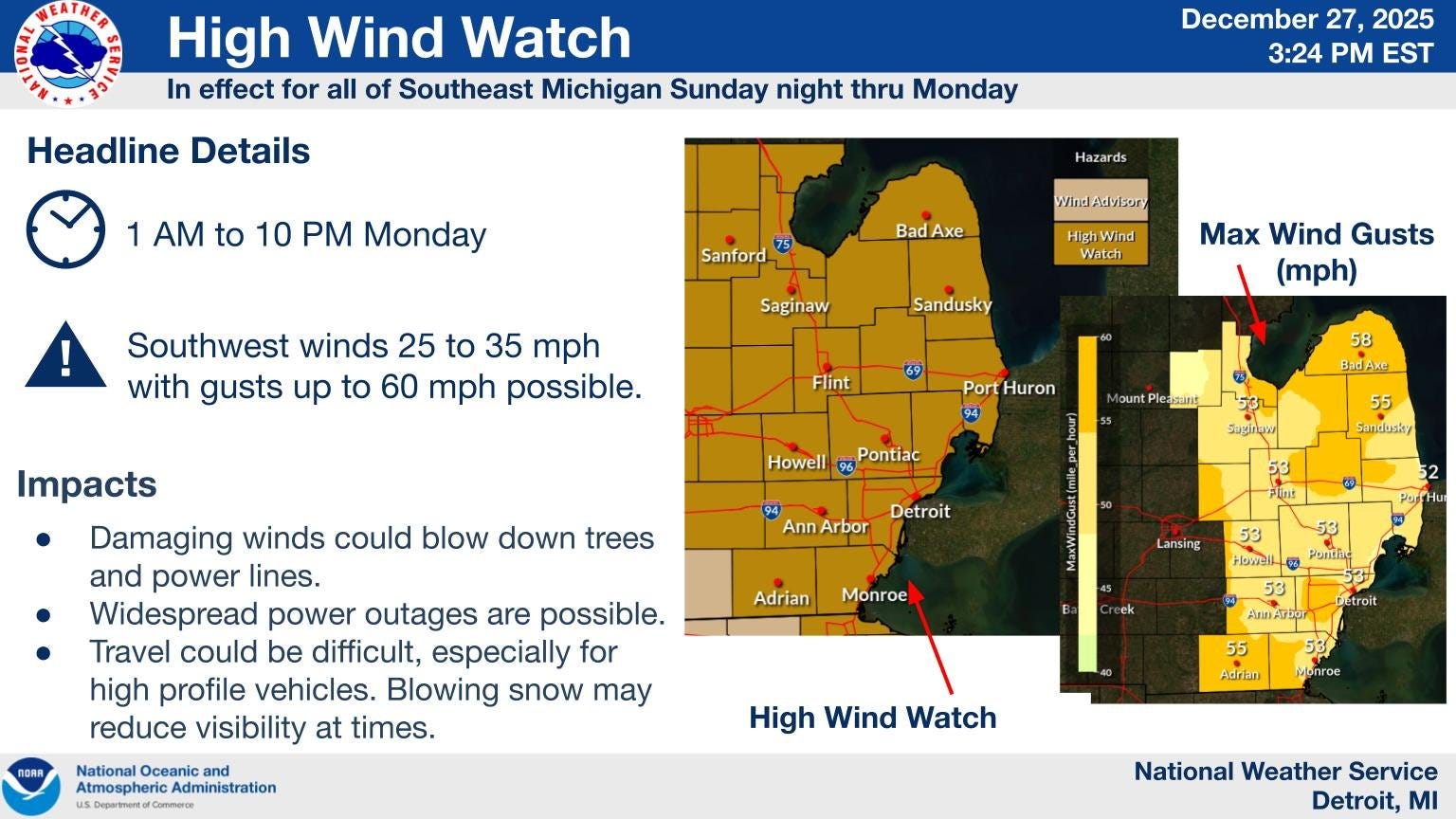
In southern and southeast Michigan, including the Detroit area, precipitation may begin as rain or freezing rain before transitioning to snow. Ice accumulation remains a concern, especially during periods when temperatures hover near freezing. Snow totals are expected to be lighter than in northern parts of the state, but even small amounts of ice could make roads slick.
Central Michigan, including the Lansing region, may experience periods of freezing rain or sleet before changing to snow. Snow accumulations are expected to be modest, but gusty winds and ice could worsen travel conditions and increase the risk of power outages.
In west Michigan and lakeshore communities, precipitation is expected to change from rain or freezing rain to snow as colder air moves in. Strong winds near Lake Michigan could lead to blowing snow and reduced visibility at times.
The northern Lower Peninsula is expected to see mainly snow, with accumulating snowfall and periods of blowing snow. Travel could be difficult, particularly in open and rural areas.
West Michigan
West Michigan is expected to see a transition from rain to winter weather through Tuesday as colder air moves into the region. Rain or a wintry mix may occur early before changing to snow Sunday night into Monday.
Snow showers are likely at times Monday and Monday night, with accumulating snow possible, especially near the Lake Michigan shoreline. Strong winds are also expected, with gusts capable of producing blowing snow and reduced visibility, particularly in open and lakeshore areas.
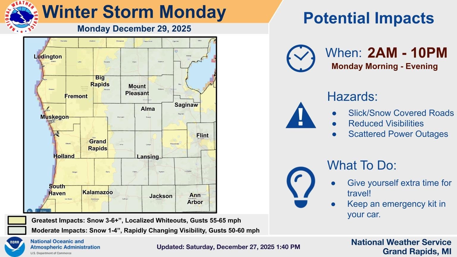
Travel may become difficult at times due to slick roads, drifting snow and changing conditions, and residents are urged to monitor forecasts as the system evolves.
Upper Peninsula
The Upper Peninsula is expected to see mostly snow during the storm, with generally lighter accumulations than major winter storms earlier this season. Gusty winds could lead to areas of blowing snow, especially in open locations and along exposed roadways.
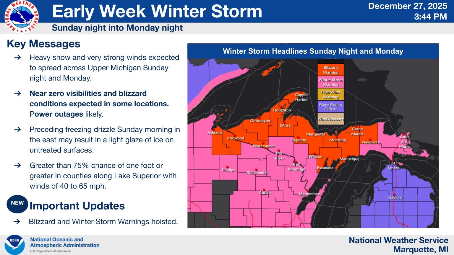
Lake enhanced snowfall is possible near Lake Superior, but widespread extreme conditions are not currently expected.
What residents should expect
Strong winds are expected across much of the state at times, increasing the potential for drifting snow and isolated power disruptions. Officials advise drivers to slow down, allow extra travel time and carry winter emergency supplies.
Residents are encouraged to stay informed through local forecasts and weather alerts as conditions change through Tuesday.